Sent to you by nigel via Google Reader:
via The Big Picture on 9/8/08
Hurricane Ike just rolled across Cuba, and soaked parts of Haiti - both regions still reeling from recent Hurricane Gustav. Ike appears to be weakening now, but is headed tward the Gulf Coast of the U.S., and may yet strengthen. The crew aboard the International Space Station was able to take a photo of Ike from 220 miles overhead last Thursday - one in a long series of great NASA photographs of hurricanes from space. Here are some of the best, from the past several years. (25 photos total)
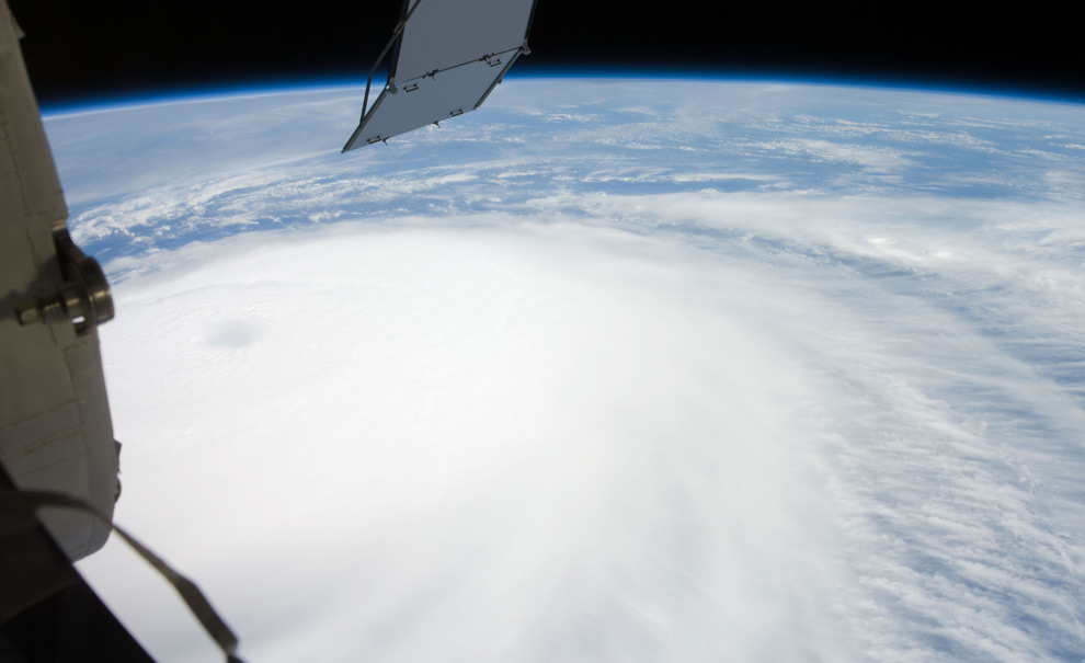
Hurricane Ike was still a Category 4 storm on the morning of Sept. 4 when this photo was taken from the International Space Station's vantage point of 220 miles above the Earth. The season's seventh named storm was churning west-northwestward through the mid-Atlantic Ocean sporting winds of 120 nautical miles per hour with gusts to 145. (photo courtesy NASA and the crew of the International Space Station)
Things you can do from here:
- Subscribe to The Big Picture using Google Reader
- Get started using Google Reader to easily keep up with all your favorite sites
No comments:
Post a Comment